How to use REAL?
Three simple steps to transform your project from concept to reality
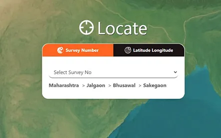
Step 1
 Search
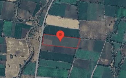
Step 2
 View
View
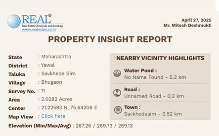
Step 3
 Download
From real estate to rural lending, insurance to infrastructure — REAL delivers survey-verified boundaries, satellite analytics, and AI-powered insights that drive faster, more reliable decision-making.
One Platform. Multiple Industries. Infinite Possibilities.
REAL is ADL’s flagship geospatial intelligence platform that combines authentic cadastral data,
high-resolution satellite imagery, and AI-driven analytics.
It is the single, unified foundation that powers smarter land and crop decisions across India.
Three simple steps to transform your project from concept to reality
Search
View
Download
Survey-verified boundaries & digital maps for faster, dispute-free deal closure.
Read More →Geo-tagged farm verification, crop analytics, and portfolio monitoring for secure lending.
Read More →Historical crop & land data for accurate underwriting and faster claim validation.
Read More →Survey-based intelligence for precise project planning and land acquisition.
Read More →