How to use REAL Maps?
Three simple steps to transform your project from concept to reality
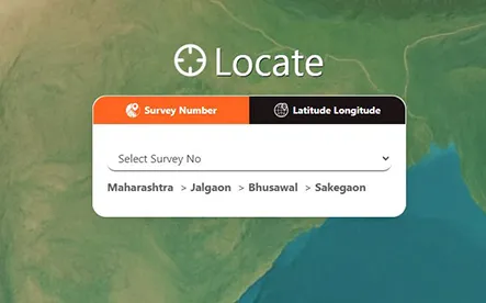
Step 1


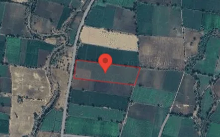
Step 2

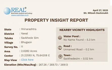
Step 3

From real estate to rural lending, insurance to infrastructure — REAL maps delivers survey-verified boundaries, satellite analytics, and AI-powered insights that drive faster, more reliable decision-making.
One Platform. Multiple Industries. Infinite Possibilities.
REAL maps is ADL’s flagship geospatial intelligence platform that combines authentic cadastral data,
high-resolution satellite imagery, and AI-driven analytics.
It is the single, unified foundation that powers smarter land and crop decisions across India.
Three simple steps to transform your project from concept to reality
Survey-verified boundaries & digital maps for faster, dispute-free deal closure.
Read More →Geo-tagged farm verification, crop analytics, and portfolio monitoring for secure lending.
Read More →Historical crop & land data for accurate underwriting and faster claim validation.
Read More →Survey-based intelligence for precise project planning and land acquisition.
Read More →